Your browser doesn't use stylesheets, or has turned off the use of our stylesheet. Although you won't get the page design we intend, you should still see all of the contents and links, in a reasonable order of appearance.
This is a new set of pages, still under contruction, about the hills. We would be glad of contributions of information about the hills, eg on access, what can be seen, and the history.
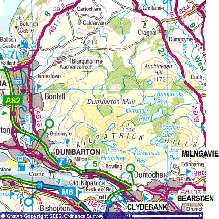
Image produced from the Ordnance Survey Get-a-map service. Image reproduced with kind permission of Ordnance Survey.
Sub-topics index: other pages on the Kilpatrick Hills
| Access | what is there? | history of Kilpatrick Hills |
back to the Kilpatrick Hills
| Access | what is there? | history of Kilpatrick Hills |
back to the Kilpatrick Hills
http://www.clydebelt.org.uk/hillsaccess.html created 27/5/03, last modified 12/11/04 by Gordon.